Get our free extension to see links to code for papers anywhere online!Free add-on: code for papers everywhere!Free add-on: See code for papers anywhere!
 Add to Chrome
 Add to Firefox
 Add to Edge
Estimating Chicago's tree cover and canopy height using multi-spectral satellite imagery
Dec 09, 2022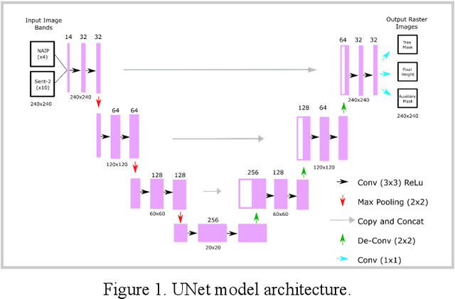
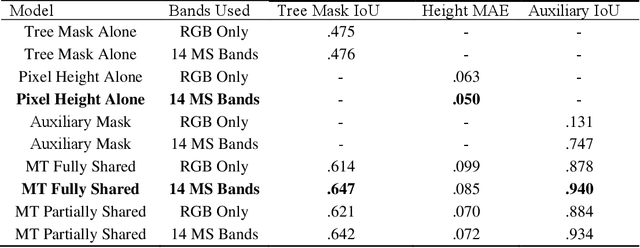
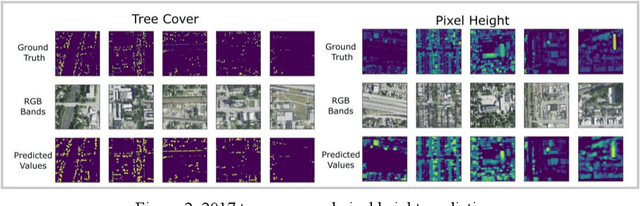
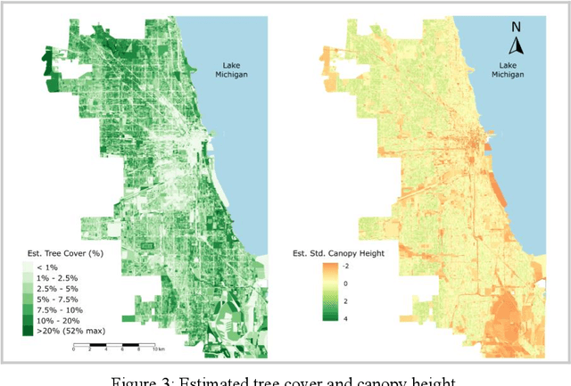
Information on urban tree canopies is fundamental to mitigating climate change [1] as well as improving quality of life [2]. Urban tree planting initiatives face a lack of up-to-date data about the horizontal and vertical dimensions of the tree canopy in cities. We present a pipeline that utilizes LiDAR data as ground-truth and then trains a multi-task machine learning model to generate reliable estimates of tree cover and canopy height in urban areas using multi-source multi-spectral satellite imagery for the case study of Chicago.
* 4 pages, 4 figures, Submitted to Tackling Climate Change with Machine
Learning: workshop at NeurIPS 2022
View paper on